Previous - Home - Next
Lowest Astronomical Tide : LAT = line between green and blue Mean High Water Spring tide : MHWS = line beween green and yellow The MHWS contour marks the boundary between land and sea. However during a HAT the water level may rise above this level (in Darwin up to 1.1 m). 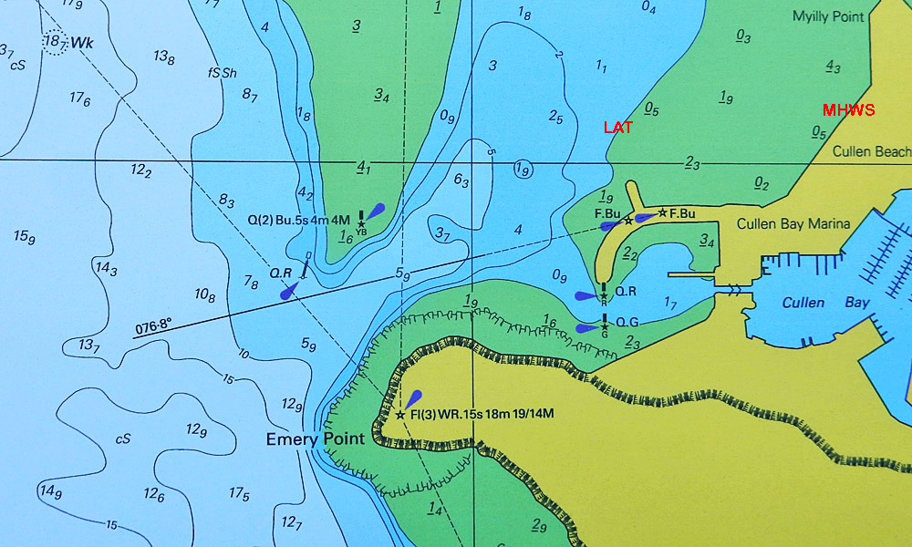
|