Previous - Home - Next
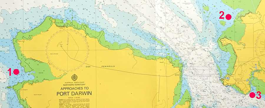
| Place | Lat S | Long E | Heights in metres above Datum | |||||
|---|---|---|---|---|---|---|---|---|
| HAT | MHWS | MHWN | MSL | MLWN | MLWS | |||
| 1. Tapa Bay 2. Nightcliff 3. Darwin | 12° 27' 12° 23' 12° 28' | 130° 36' 130° 50' 130° 51' | 7.1 7.5 8.1 | 6.2 6.6 7.0 | 4.6 4.8 5.0 | 3.8 3.9 4.1 | 2.9 3.0 3.2 | 1.3 1.3 1.3 |
|
The outer approach to Darwin Harbour is shaped like a funnel with its narrowest point EW across from the Naval Base. With high tides, the full width of water has to go through this narrow part of the waterway. The result is a rise (bulging) of the water in (and South of) this area and a much slower Flood stream (at 2.5 knots) than when the water flows out of the harbour with the Eb stream (at 4.5 knots). This is reflected in the different HAT levels in Tapa Bay (1), Nightcliff (2) and Darwin (3), which only gradually diminishes, then dissapears, as the tide levels get lower. | ||||||||