|
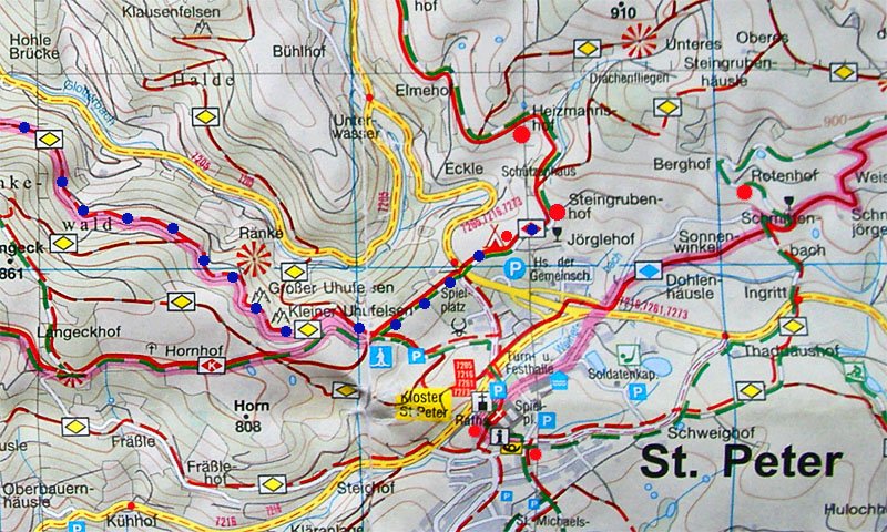
Steingrubenhof - St.Peter village square = 1.2km
Large red dots show Heitzmannshof (Wivica's home), Steingrubenhof (my holiday apartment) and Rotenhof (Barbara's farm, where Antien and Babette stayed last year, 2009)
Small red dots show the Waldcafé (next to the camping ground sign), village square with Café Martin and Ristorante Bertolds Brunnen (opposite the church) and the Zäringer Eck Bistro (opposite the Post office).
The small blue dots show part of the walking trail I took to Glottertal along the Kleiner and Grosser Uhufelsen (Owl rock formations).
The North West running yellow road along the Glotterbach leads to Glottertal. The East running yellow road leads to Sankt Märgen, and the South Westerly running yellow road leads to Kirchzarten.
|

