Other maps - Regional map - Blog
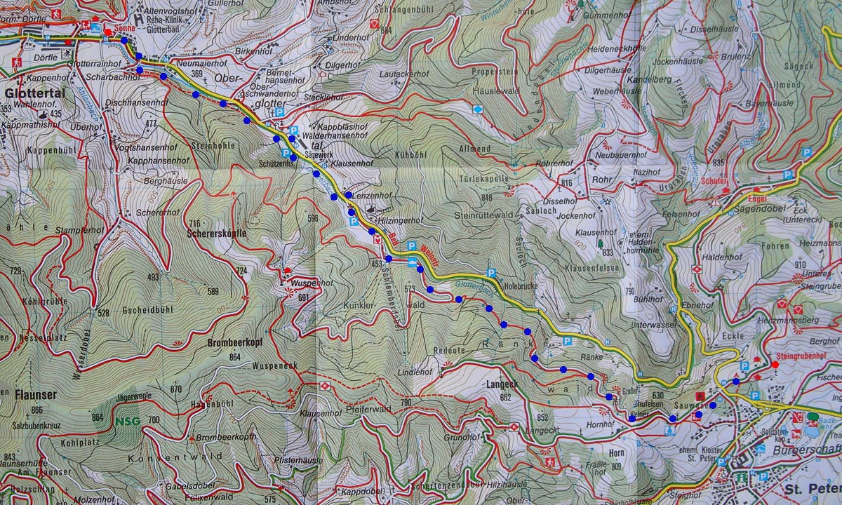 1. St.Peter - Glottertal : 8km
 | 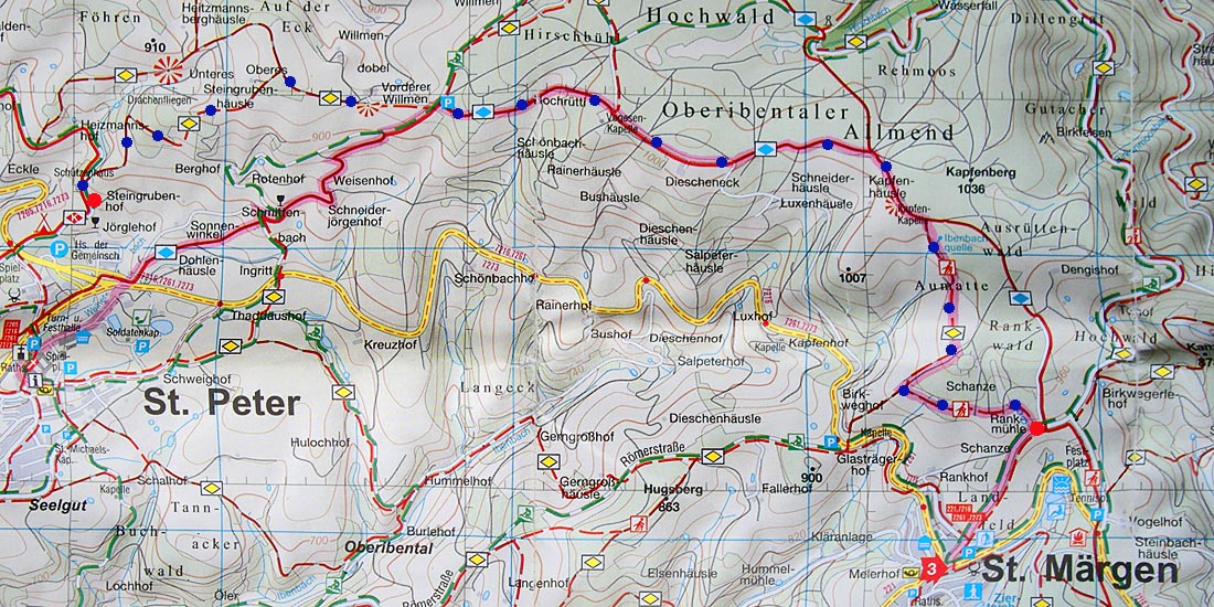 2. St Märgen - St Peter : 8km
 | 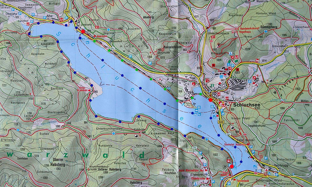 3. Aha - Schluchsee dam : 9km
 |
|
4. Aha - Schluchsee Railway Station : 4.5km
| 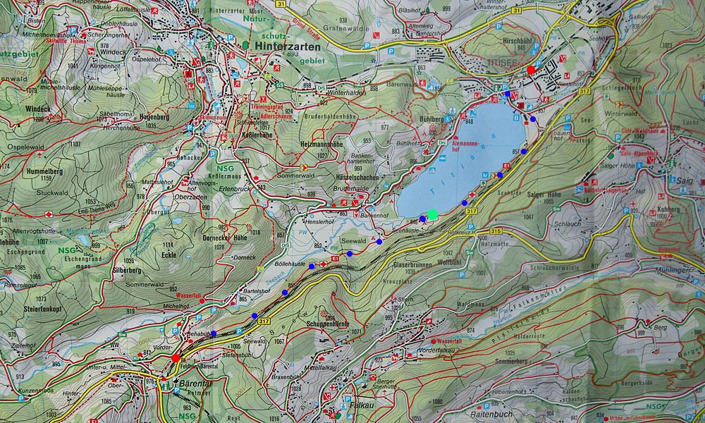 5. Bärental - Titisee : 6.5km
 | 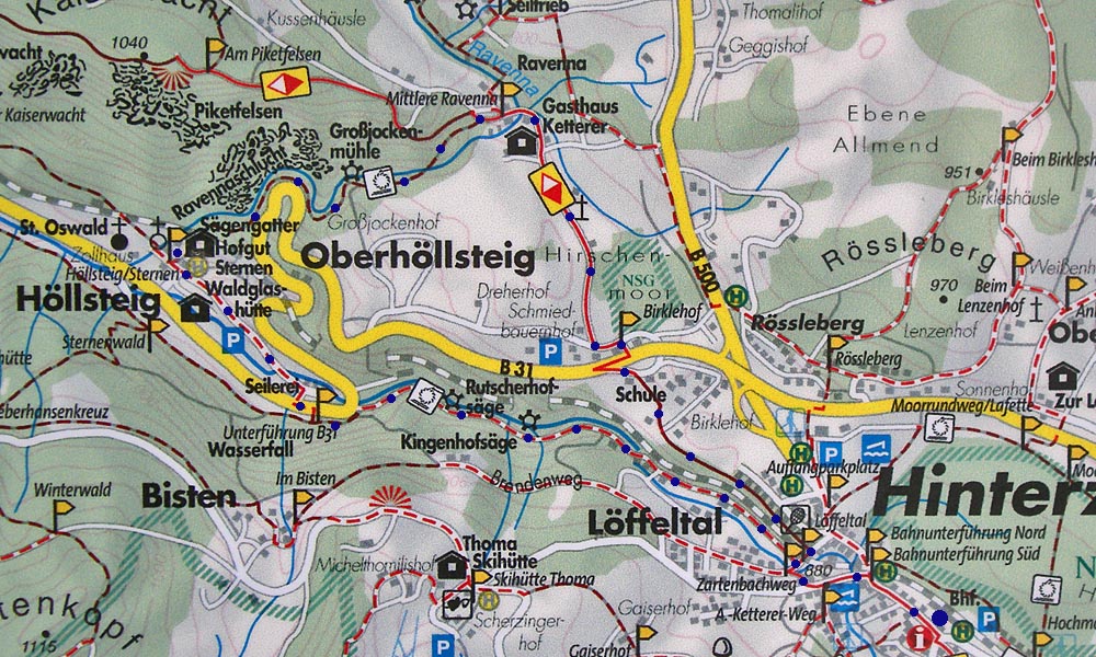 6. Löffeltal - Ravennaschlucht : 8km
|
| ||
|
1. St.Peter - Glottertal : 8km |
2. St Märgen - St Peter : 8km |
3. Aha - Schluchsee dam : 9km |
|
4. Aha - Schluchsee Railway Station : 4.5km
|
5. Bärental - Titisee : 6.5km |
6. Löffeltal - Ravennaschlucht : 8km
|
| ||