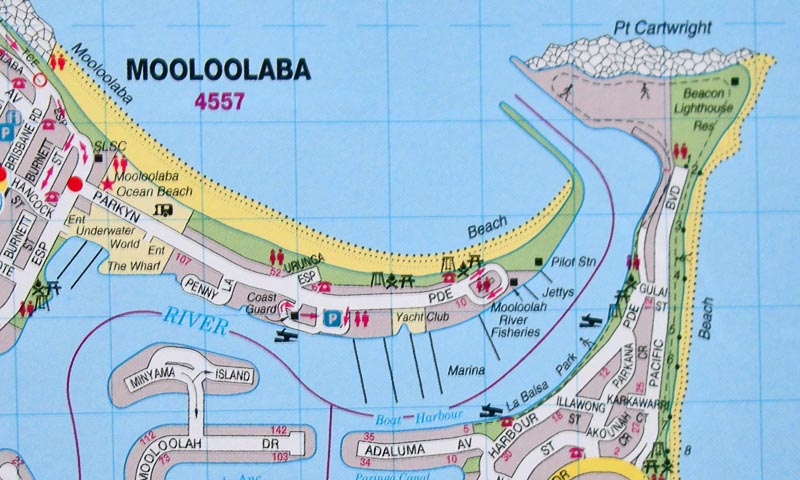
You can clearly see the fish hook shape of the (yellow) beach and (green) dune strip, surrounded by water, the Pacific Ocean to its north, the Mooloolah River to the south of it.
The Surf Club is the black square marked SLSC ("Surf Life Savers Club), with the Mooloolaba Ocean Beach Caravan Park (where I sometimes stay) just to the right of it. I usually swim at a patroled swim area halfway along the beach, right opposite the short Urunga Esplanade. The walking trail through the dunes is not marked on this map.
|